Eagle utililsation surveys
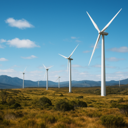
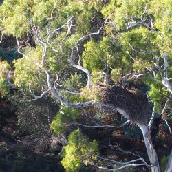
Assessments for renewable energy projects are a major part of our workload, with eagle utilisation surveys being integral in this process. Over the past two years, our highly experienced ecologists and fauna specialists have been spending long hours in the field, braving all four seasons of Tasmania’s highland weather, observing both the Tasmanian wedge-tailed eagle (Aquila audax fleayi) and the white-bellied sea-eagle (Haliaeetus leucogaster) (as well as a range of other raptors) and documenting their flight patterns as a measure of how they utilise and interact with their environment. Each season, for two weeks at a time, 10-12 hours a day, rain, hail or shine, our ecologists mapped the flight paths of these two species of eagle, whilst simultaneously sipping necessary cups of hot tea and coffee.
Understanding how these large birds move around their environment gives us insight into their flight behaviours, preferred flight paths, and their interactions with one another. The data gathered from our surveys are then used to inform predictive modelling of high-risk areas for collisions with future infrastructure such as wind turbines. This process thus guides future infrastructure location and design as a measure of collision mitigation, as well as providing baseline data for tracking eagle persistence and behaviour (including altered flight paths) in the landscape after a development. The application of this method thus has the potential to greatly improve our understanding of eagles in developed landscapes, which can feed directly into a new recovery plan.


